Be part of the Citified community! Join our slack workspace and help us get a dialog going about how cities can be better for people and better for the planet.
-
Almost every article, briefing, lecture or essay on matters of urbanisation seems to make reference to the extent of urbanisation in the world today and the expected urban population globally in the future. Often, such material specifically refers to the well established benchmark of the UN World Urbanization Prospects publication1.
So it is perhaps surprising to find that the level of standardisation of the urbanisation figures, or specifically the methodology used to derive them, is very low. In the case of the “official” UN figures, national methods are used and aggregated without a huge effort to ensure there is a degree of alignment between the various approaches.
This recent OECD paper2 goes some way to both understanding the deficiencies in existing metrics and in proposing alternatives which might provide a better baseline for understanding a) what “urban” really means in the context of measuring populations, and b) the methods which can be deployed to effectively measure on this basis.
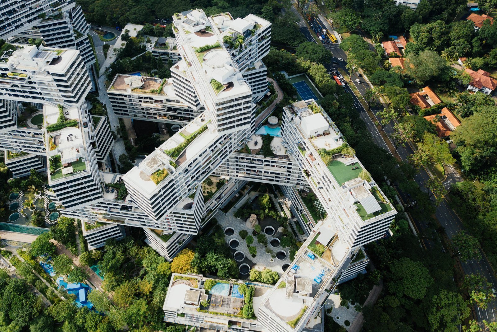
An extensive review of approaches covers population density by area and by administrative designation, designation by infrastructure provision and finally rural employment. None is “correct”, but for a globally deployable methodology only the first makes sense. Several limitations of a naive approach must be overcome however.
The proposed methodology, a population grid with units of land designated as city, town, suburban or rural, overcomes some of the inconsistencies identified with the existing approaches. The authors address unit size when defining the grid, acknowledging that manipulation of the grid resolution will dramatically effect the output of a given survey. Density, as the primary factor in the assignment of categorisation to each cell, allows urban areas to be identified by applying additional rules about clusters of contiguous urban cells and the total population within these designated clusters.

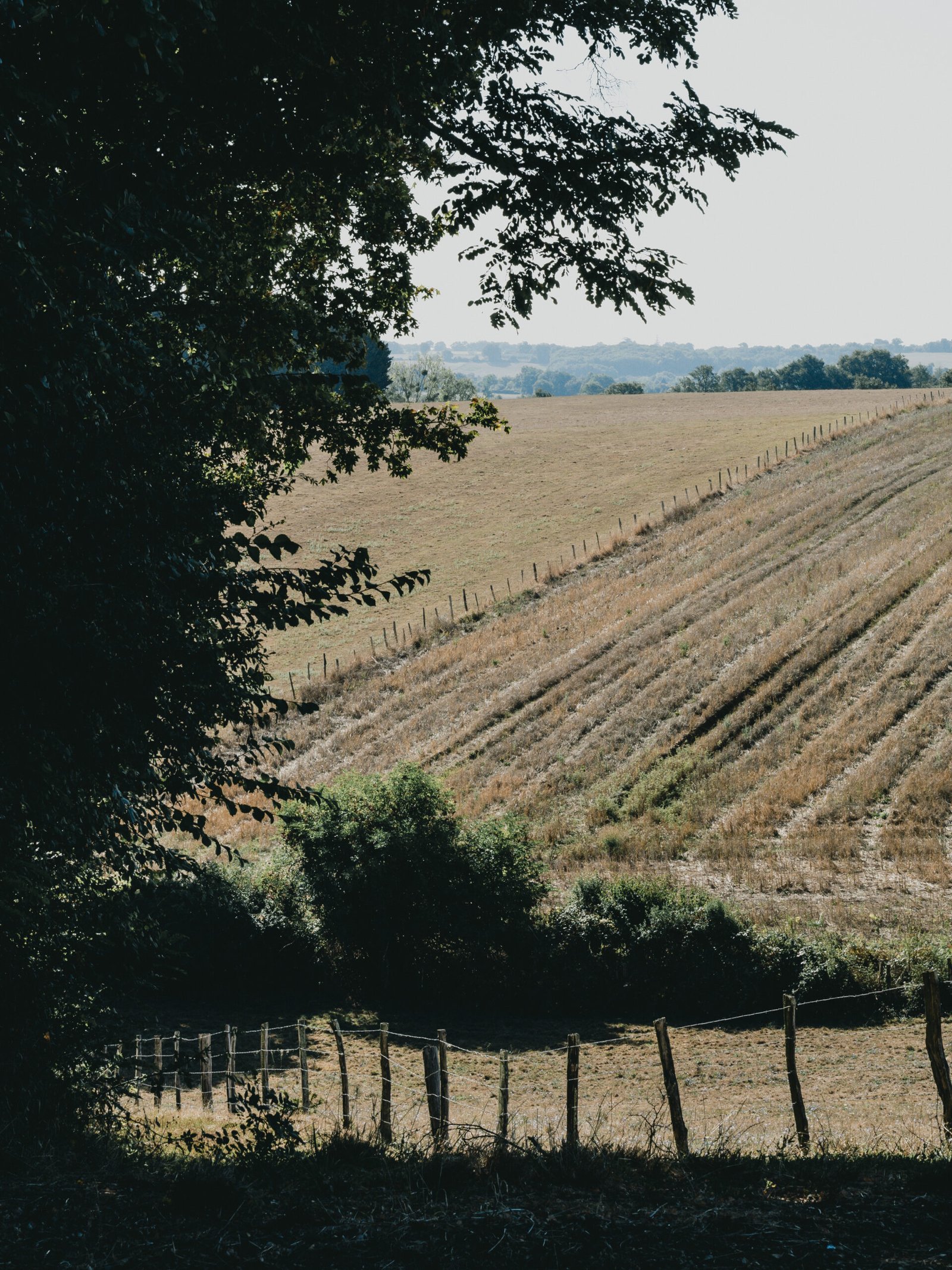
Demonstrating the categorisation of land around Cork, Ireland. 3 Dealing with density variation
Ulaanbaatar, the capital of Mongolia, is a city with 1.4 million inhabitants. The area of the municipality is particularly big with 4,700 sq km. As a result, the density of this municipality is very low: less than 300 inhabitants per sq km. Purely relying on municipal densities would inevitably mean that Ulaanbaatar would be classified as rural.4
To overcome the issue illustrated by this example, specifically the designation of urban population in areas with low density, the authors proposed additional categories which allow low density urban clusters to be designated as such. This approach disambiguates such areas from, for example, sub-urban zone around a more densely populated urban centre. In selecting regions for analysis of the potential of experiments or initiatives which make an assumption of density, this additional granularity will enable significantly more accurate forecasting of efficacy.
It is clear that there remains work to be done to establish a recognised means of designating urban areas and differentiating between urban populations with materially different characteristics. However, in this paper I found answers to many of my own questions about the degree of urbanisation in the world today, and a rigorous analysis of the shortcomings of the data being both existing measures and the new proposal. In the conclusions set out in the paper, it is clear that the new method raised few surprises in the Americas, Europe and Oceania. However in Africa and Asia the findings demonstrate a clear discrepancy in the interpretation of “urban” which may, with better data, lead to a much higher measure of urban population today than previously thought.
-
A stark reminder this week that there are two sides to the renewable energy revolution: supply and demand. Whilst we in Denmark can be proud of our record on the supply side of this equation, the recent increase in interest from big tech in locations with good renewable credentials does suggest that governments may be called upon to impose some control on the demand side also.
The problem is that Denmark’s green energy has its limits. There is no way that existing renewables facilities could hope to meet the prospective demand from data centers.
https://www.citylab.com/environment/2018/06/denmarks-carbon-footprint-is-set-to-rise-sharply/563486/ -
The skate park at Bexhill leisure centre, now earmarked for demolition, has an incredibly passionate and vibrant community of riders and skaters.
The skate park is in desperate need of renovation – several accidents and near misses due to the state of the ramps and concrete occurred during the shooting of these photos. And with demolition on the horizon, the community here deserve a firm commitment from local government to the development of a new location.
Skate parks are positive and sociable community hubs which deserve serious investment to ensure they are safe spaces for up and coming athletes to practice and share their passion with others.
")
")
")
")
")
")
")
")
")
")
")
")
")
")
")
")
")
")
")
")
")
")
")
")
")
")
")
")
")
")
")
")
")
")
")
")
")
")
")
")
")
")
")
")
")
")
")
")
")
")
")
")
")
")
")
")
")
")
")
")
")
")
")
")
")
")
")
")
")
")
")
")
")
")
")
")
")
")
")
")
See more:
-
Evolving Specialised Species in Diverse Simulated Ecologies using a Subsumption ArchitectureDownload
Back in 2006, three years in to my degree in “computer systems and software engineering” at the University of York, I embarked on my Masters project. The ambition was quite clear – to use a complementary suite of AI algorithms to simulate speciation. The choice of algorithm for behaviour selection, Rodney Brooks’ subsumption architecture, was dictated by my supervisor, but despite the existence of prior work on the use of the subsumption architecture, the existing implementation was missing key prerequisites for achieving the ambition of the project. Specifically the ability to vary the geographic (and other environmental) conditions such that speciation might occur.
Whilst I learned many things from the arduous process of trying to run successful experiments on this journey, none were so precious as the respect I developed for the complexity of systems. The combination of two core AI algorithms, a broad range of environmental variables and the entropy of unpredictable individual behaviour across a population of hundreds over thousands of generations, led to a huge degree of complex, emergent outcomes. Controlling these outcomes became a huge challenge for me, preventing me from obtaining the evidence I needed to support some conclusions I knew it was possible to draw. The experience was humbling, educational and frustrating in equal parts. The write up I submitted can be viewed at this link. I will eventually edit and post a subsequent revision which includes conclusions drawn after further experimentation past the submission deadline!
-
A couple of images of submissions for this Coursera course I studied recently.


-
Fjellfolk is dedicated to providing a manageable, curated feed of news, essays and opinions on the subject of cities, technology and sustainability. Specifically we believe that cities, and the growing population of people who inhabit cities, represent both a significant sustainability challenge but also hold the key to overcoming these challenges.
I’d love to think that the content here will stimulate critical thinking and ideation to further grow the community of engaged citizens who have seen the future and realise we simply must find a way to live in harmony with our planet.
As a keen photographer, many photos on this site will be my own, but others are gratefully used with permission from those applying a creative commons licence to their good work. Wherever I’ve done so credit is given to the artist.
Photo by Eugene Triguba on Unsplash
-

The satellite dish. That reliable, omnipresent parabolic residential appendage, facilitating technology for the rise of satellite television in the late 70s, and modern day delivery medium for Murdoch’s media empire. On a short impromptu photowalk in somewhat economically deprived Bexhill-on-Sea my lens inadvertently captured a huge range of the rusted concave devices, their cables trailing across rooftops like determined vines clamouring for vertical dominance, terminating at this strange metal plate seeking a favourable situation on a pebbledash plain. I wondered: to what extent could the “dish density” of an area be a socioeconomic indicator?

They will sell you a dish outside Asda. Aspiring salesmen, fleece top proudly embroidered with the Sky logo, enthusiastically propping up a portable sales stand, together representing an unavoidable gauntlet between shopper and shop. The determined survive but the weakest are cornered and eventually convinced they sign, committing to 24 months of box sets, premier league and propaganda. A typical contract could cost a day’s pay packet on the minimum wage, but out there in the cold the numbers might just start to make sense.


-
Nice little article by a chap called Ajit Menon, a hobbyist photographer from New York City. Ajit talks across topics ranging from the desirability of some very expensive photography hardware to an introspective look at the ‘soul’ of his own work. Some great photos too…